Peter Lobner, updated 26 September 2023
Thanks to Lyncean member Mike Spaeth for sending me the article “What would the Earth look like if all the ice melted. The answer is terrifying,” which discusses the worst-case scenario of sea level rise after all the ice and snow currently locked away in glaciers, ice sheets and snowpacks has melted.
The bottom line is a sea level rise of 216 feet (65.8 m).
The article includes a link to a short, dramatic 2015 animated video by the same title, posted by Insider Science, which shows the global effects a 216 ft sea level rise. You can watch this video on YouTube here: How Earth Would Look If All The Ice Melted
So, what about your neighborhood? You can explore a topographical map of the San Diego area here: https://en-us.topographic-map.com/map-n9tp/San-Diego/. Zoom in to determine the land elevations in specific neighborhoods and find the locations of the 216 ft elevation contour lines.
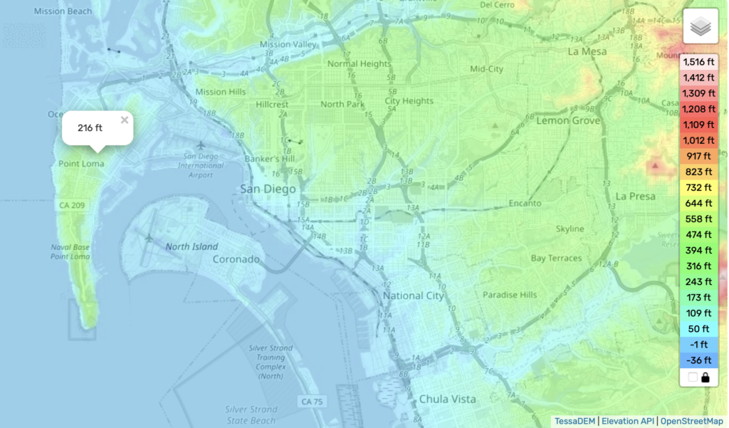
In the above map, everything in blue would be underwater after a 216 ft sea level rise, including all of Coronado, the Silver Strand, the downtown areas of San Diego, National City and Chula Vista, Lindberg Airport, Pacific Beach, Mission Valley and parts of Point Loma. Ironically, the submarine base near the tip of Point Loma would be underwater.
After you’ve found your house and the houses of families and friends in San Diego, you can expand your topographical search of the whole world. All it takes is a bit of scrolling & zooming. Some countries would be completely underwater.
Thanks to Steve Masten for sending me the link to the Sea Level Rise Viewer developed by the National Oceanographic and Atmospheric Administration (NOAA). With this visualization tool, you can see the gradual effects of sea level rise in coastal USA, up to a maximum rise of 10 feet (3 meters). Below are example results for San Diego, CA.
Current San Diego
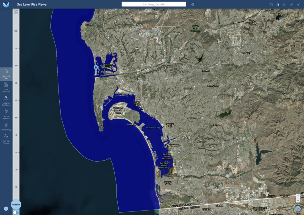
5 foot (1.5 meter) sea level rise
Note the modest impacts in low-lying areas, particularly in South Bay.
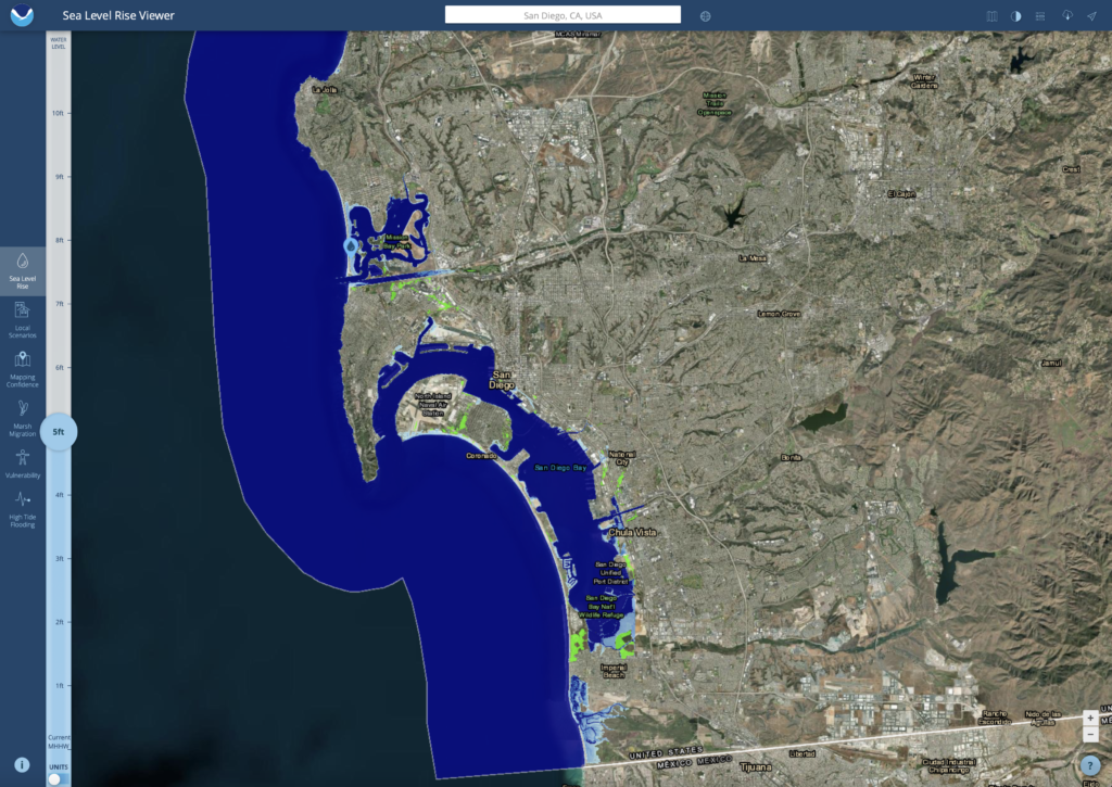
10 foot (3 meter) sea level rise
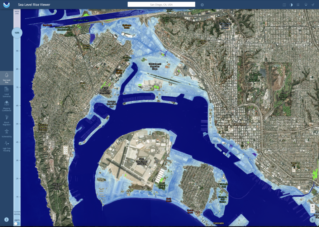
There are significant flooded areas along the eastern bayfront from downtown San Diego to National City and Chula Vista. The San Diego Airport and Loma Portal are flooded. Coronado becomes two islands and the Silver Strand is underwater, opening the South Bay to the ocean. Point Loma has become an island, and the strand of Mission Beach is underwater, opening Mission Bay to the ocean.
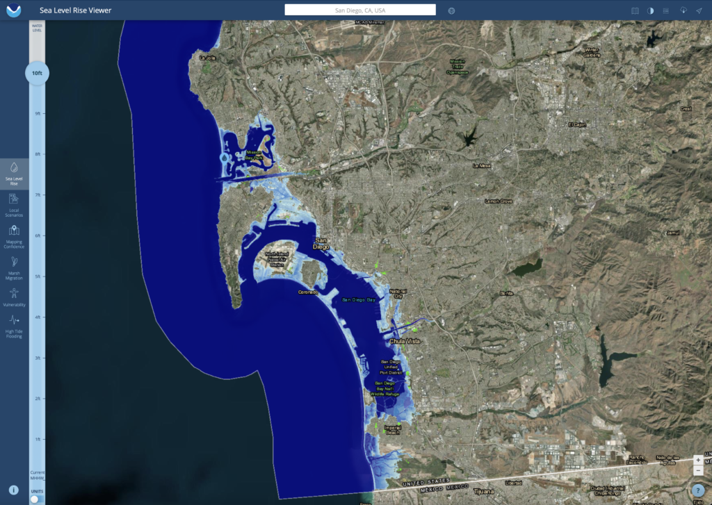
Here’s a closer look at the area around San Diego Bay after a 10 foot sea level rise.
For more information
- “What the World Would Look Like if All the Ice Melted,” National Geographic magazine, September 2013: https://www.nationalgeographic.com/magazine/article/rising-seas-ice-melt-new-shoreline-maps
- Jisha Jodeph, “What would the Earth look like if all the ice melted. The answer is terrifying,” Scoop Upworthy, 17 September 2023: https://www.msn.com/en-us/weather/topstories/what-would-the-earth-look-like-if-all-the-ice-melted-the-answer-is-terrifying/ar-AA1gS8SD