Peter Lobner
Scientists at NASA’s Goddard Space Flight Center generate groundwater and soil moisture drought indicators each week. They are based on terrestrial water storage observations derived from GRACE satellite data and integrated with other observations, using a sophisticated numerical model of land surface water and energy processes. You can see current results for the continental U.S. at the following link to the National Drought Mitigation Center (NMDC), University of Nebraska-Lincoln, website:
http://drought.unl.edu/MonitoringTools/NASAGRACEDataAssimilation.aspx
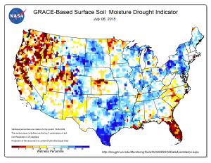
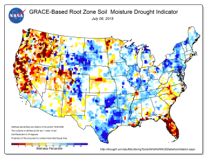
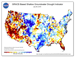
Drought indicator maps for 6 July 2015 are reproduced below for:
- Surface soil moisture
- Root zone soil moisture
- Shallow groundwater
The drought in the U.S. West looks most severe in the shallow groundwater map.
You can find information on the twin GRACE (Gravity Recovery and Climate Experiment) satellites at the following link:


