Category Archives: Arctic

Ulstein’s Nuclear-powered Thor and its All-electric Companion Vessel Are a Zero-Carbon Solution for Marine Tourism

Peter Lobner

1. Introduction

In June 2022, the Norwegian firm Ulstein (https://ulstein.com) announced their conceptual design of a Replenishment, Research and Rescue (3R) vessel named Thor that will be powered by a thorium molten salt reactor (MSR). This vessel can function as a seaborne mobile charging station for a small fleet of electrically-powered expedition / cruise ships that are designed to operate in environmentally sensitive areas such as the Arctic and Antarctic. Other environmentally sensitive areas include the West Norwegian Fjords, which are UNESCO World Heritage sites that will be closed in 2026 to all ships that are not zero-emission. In the future, similar regulations could be in place to protect other environmentally sensitive regions of the world, thereby reinforcing Ulstein’s business case behind Thor and its all-electric companion vessels.
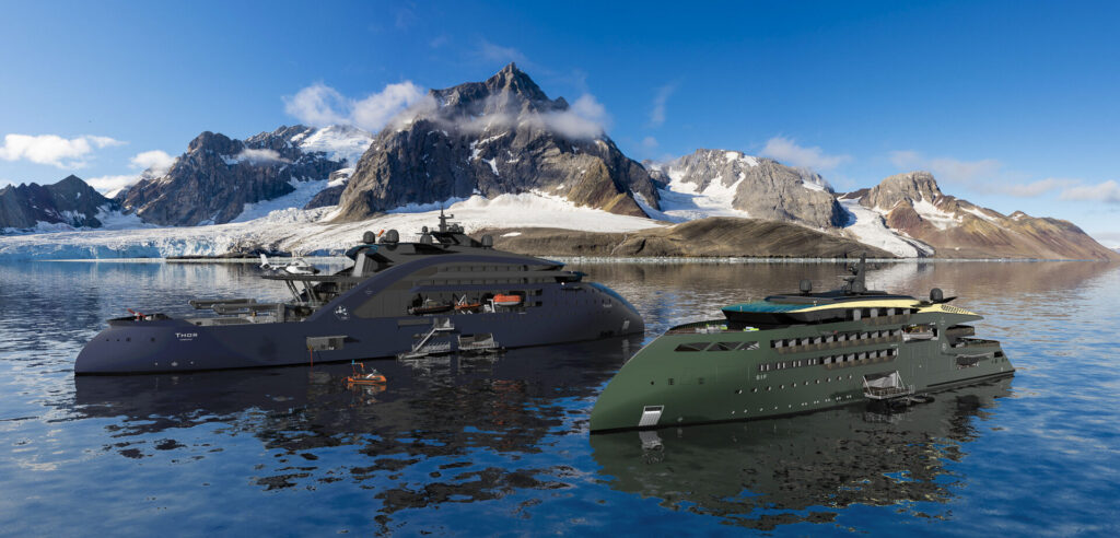
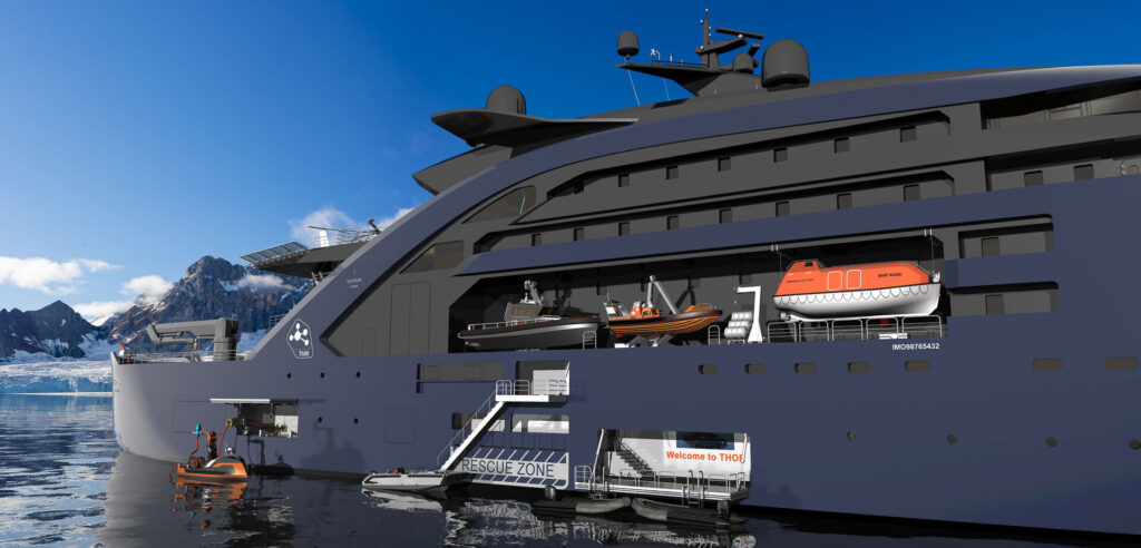
Ulstein’s Thor MSR-powered vessel (left) and 
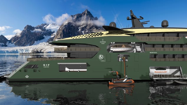
Sif electrically-powered expedition / cruise vessel (right). 
Source: Ulstein

2. The MSR-powered Thor charging station

Thor is a 149-meter (500-foot) long, zero-emission, nuclear-powered vessel that features Ulstein’s striking, backwards-sloping X-bow, which is claimed to result in a smoother ride, higher speed while using less energy, and less mechanical wear than a ship with a conventional bow. 

For its R3 mission, Thor would be outfitted with work boats, cranes, a helicopter landing pad, unmanned aerial vehicles (UAVs), unmanned surface vessels, firefighting equipment, rescue booms, a lecture hall and laboratories.

As a charging station, Thor would be sized to recharge four all-electric vessels simultaneously.
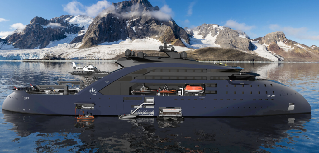
Thor.  Source: Ulstein

Thor also could serve as a floating power station, replacing diesel power barges in some developing countries or in some disaster areas while the local electric power infrastructure is being repaired.

Ulstein projects that an operational Thor vessel could be launched in “10 to 15 years.” However, the development and licensing of a marine MSR is on the critical path for that schedule.  
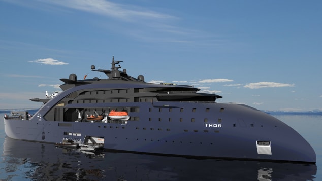
Thor, starboard side views.  Source, both graphics: Ulstein

3. The all-electric Sif expedition / cruise ship

Sif, named after the goddess who was Thor’s wife, is a design concept for a 100-meter (330-foot) long, all-electric, zero-emission expedition / cruise ship designed to operate with minimal impact in environmentally sensitive areas. The ship will be powered by a new generation of solid batteries that are expected to offer greater capacity and resistance to fire than lithium-ion batteries used commonly today.  It will be periodically recharged at sea by Thor.

The ship can accommodate 80 passengers and 80 crew. 
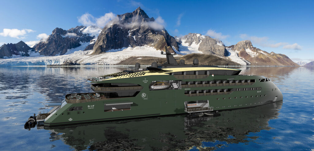
Sif, starboard side view.  Source, both graphics: Ulstein

4. A marine MSR power plant

The pressurized water reactor (PWR) is the predominant marine nuclear power plant in use today, primarily in military vessels, but also in Russian icebreakers and a floating nuclear power plant in the Russian Arctic. 

Ulstein reported that it has been exploring MSR technology because of its favorable operating and safety characteristics. For example, an MSR operates at atmospheric pressure (unlike a PWR) and passive features and systems maintain safety in an emergency. If the core overheats, the molten salt fuel/coolant mixture automatically drains out of the reactor and into a containment vessel where it safely solidifies and can be reused.  You’ll find a good overview of MSR technology here: https://whatisnuclear.com/msr.html

While a few experimental MSRs have operated in the past, no MSR has been subject to a commercial nuclear licensing review, even for a land-based application. Ulstein favors a thorium-fueled MSR. The thorium-uranium-233 fuel cycle introduces additional technical and nuclear licensing uncertainties because of the lack of operational and nuclear regulatory precedents.

Several firms are developing MSR concepts. However, the combination of a marine MSR and a thorium fuel cycle remains elusive. Two uranium-fueled marine MSR design concepts are described below.

Seaborg Technologies

The Danish firm Seaborg Technologies (https://www.seaborg.com), founded in 2014, is developing a compact MSR (CMSR) with a rating of about 250 MWt / 100 MWe for use in power barges (floating nuclear power plants) of their own design (see my 16 May 2021 post). The thermal-spectrum CMSR uses uranium-235 fuel in a molten proprietary salt, with a separate sodium hydroxide (NaOH) moderator.  

A Seaborg Technologies CMSR module could generate 100 MWe. Dump tank shown below reactor. Source: Seaborg via NEI (2022)

Seaborg’s development time line calls for a commercial CMSR prototype to be built in 2024, with commercial production of power barges beginning in 2026. 

Source: Seaborg (2022)

In April 2022, Seaborg and the Korean shipbuilding firm Samsung Heavy Industries signed a partnership agreement for manufacturing and selling turnkey CMSR power barges. 

On 10 June 2022, Seaborg was selected by the European Innovation Council to receive a significant (potentially up to €17.5 million) innovation grant to help accelerate their work on the CMSR.

CORE-POWER and the Southern Company consortium

The UK firm CORE-POWER Ltd. (https://corepower.energy), founded in 2018, began with a concept for a compact uranium-235 fueled, molten chloride salt reactor named the m-MSR for marine applications. This modular, inherently safe, 15 MWe micro-reactor system was designed as a zero-carbon replacement power source for the fossil-fueled power plants in many existing commercial marine vessels.  It also was intended for use as the original power source for new vessels, as proposed for the Earth 300 Eco-Yacht design concept unveiled by entrepreneur Aaron Olivera in April 2021 (see my 17 April 2021 post). The power output of a modular CORE-POWER m-MSR installation could be scaled to meet operational needs by adding reactor modules in compact arrangements suitable for shipboard installation. 
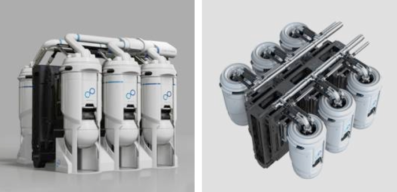
A set of six small, compact CORE-POWER m-MSR modules
could generate 90 MWe. Dump tank not shown. Source: CORE-POWER

In November 2020, CORE-POWER announced that it had joined an international consortium to develop MSRs. This team includes the US nuclear utility company Southern Company (https://www.southerncompany.com), US small modular reactor developer TerraPower (https://www.terrapower.com) and nuclear technology company Orano USA (https://www.orano.group/usa/en). In the consortium, TerraPower is responsible for the fast-spectrum Molten Chloride Fast Reactor (MCFR). CORE-POWER is responsible for maritime readiness and regulatory approvals.

This consortium applied to the US Department of Energy (DOE) to participate in cost-share risk reduction awards under the Advanced Reactor Demonstration Program (ARDP), to develop a prototype MCFR as a proof-of-concept for a medium-scale commercial-grade reactor. In December 2020, the consortium was awarded $90.4 million, with the goal of demonstrating the first MCFR in 2024.  DOE reported, “They expect to begin testing in a $20 million integrated effects test facility starting in 2022. The team has successfully scaled up the salt manufacturing process to enable immediate testing. Data generated from the test facility will be used to validate thermal hydraulics and safety analysis codes for licensing of the reactor.”In February 2021, CORE-POWER presented the MCFR development schedule in the following chart, which shows the MCFR becoming available for deployment in marine propulsion in about 2035.  This is within the 10 to 15 year timescale projected by Ulstein for their first Thor vessel.
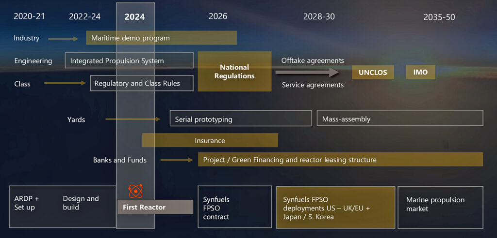
Source: CORE-POWER (2021)

5. In conclusion

A seaborne nuclear-powered “charging station” supporting a small fleet of all-electric marine vessels provides a zero-carbon solution for operating in protected, environmentally sensitive areas that otherwise would be off limits to visitors. Ulstein’s concept for the MSR-powered Thor R3 vessel and the Sif companion vessel is a clever approach for implementing that strategy.

It appears that a uranium-fueled marine MSR could be commercially available in the 10 to 15 year time frame Ulstein projects for deploying Thor and Sif.  The technical and nuclear regulatory uncertainties associated with a thorium-fueled marine MSR will require a considerably longer time frame. 

6. For additional information 

Ulstein Thor & Sif

Video

Seaborg CMSR

CORE-POWER m-MSR

Blue Glaciers, Blue Icebergs and the Antarctic Museum of Modern Art

Peter Lobner, 1 September 2020

Why is glacial ice blue?

The US Geologic Survey (USGS) provides a basic explanation of why glacial ice is blue:

“The red-to-yellow (longer wavelength) parts of the visible spectrum are absorbed by ice more effectively than the blue (shorter wavelength) end of the spectrum. The longer the path light travels in ice, the more blue it appears.  This is because the other colors are being preferentially absorbed and make up an ever smaller fraction of the light being transmitted and scattered through the ice.”

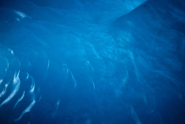
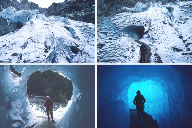
Blue ice with natural lighting inside a glacial ice cave, Grindelwald, Switzerland.
Source: P. Lobner photo

The key to blue ice is selective absorption, which occurs in a special kind of ice that is produced on land with the help of pressure and time.  Becky Oskin provides the following general insights into how this process occurs in her 2015 article, “Why Are Some Glaciers Blue?”

  1. When glacial ice first freezes, it is filled with air bubbles that are effective in scattering light passing through the ice. As that ice gets buried and compressed by subsequent layers of younger ice, the air bubbles become smaller and smaller.  With less scattering of light by the air bubbles, light can penetrate more deeply into the ice and the older ice starts to take on a blue tinge. Blue ice is old ice.
  2. Patches of blue-hued ice emerge on the surface of glaciers where wind and sublimation have scoured old glaciers clean of snow and young ice. 
  3. Blue ice also may emerge at the edges of a glacial icepack, where fragments of glaciers tumble into the sea and reveal a fresh edge of the old ice.

Stephen Warren’s 2019 paper, “Optical properties of ice and snow,” provides the following more technical description of the selective absorption process in ice:

  1. “Ice is a weak filter for red light..….the absorption coefficient of ice increases with wavelength from blue to red (but the absorption spectrum is quite complex). The absorption length…… is approximately 2 meters at (a wavelength of ) λ = 700 nm (nanometers, red end of the visible spectrum) but approximately 200 meters at λ = 400 nm (blue-violet end of the visible spectrum). Photons at all wavelengths of visible light will survive without absorption, and be reflected or transmitted, unless the path length through ice is long enough to significantly absorb the red light.”…..”Ice develops a noticeable blue color in glacier crevasses and in icebergs, especially in marine ice (i.e., icebergs calved from glacial ice shelves), because of its lack of (air) bubbles (which would otherwise cause scattering and limit light transmission through the ice).”
  2. The absorption length is the distance into a material where the beam flux has dropped to 1/e (1/2.71828 = 0.368 = 37%) of its incident flux.  For light at the red end of the spectrum, that is a relatively short distance of about 2 meters.  This means that, in 2 meters, absorption decreases the red light component of beam flux by a factor of 1/e to about 37% of the original incident red light.  In another 2 meters, the red light beam flux is reduced to about 14% of the original incident red light. At the same distances, the blue-violet end of the spectrum has hardly been attenuated at all. 

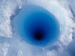
You can see that even modest size pieces of glacial ice (several meters in length / diameter) should be able to attenuate the red-to-yellow end of the spectrum and appear with varying degrees of blue tints. Looking into an ice borehole in an Antarctic ice sheet shows how intensely blue the deeper part of the glacial ice appears to the viewer on the surface.  The removed ice core is a slender cylinder of ice that looks like clear ice when viewed from the side. 

Looking down into an Antarctic ice borehole.
Source: https://giglinthefield.wordpress.com/tag/antarctica/
A segment of an ice core sample.
Source: https://sites.google.com/site/amblerspsychrophiles/

So… why is snow white? Light does not penetrate into snow very far before being scattered back to the viewer by the many facets of uncompressed snow on the surface.  Thus, there is almost no opportunity for light absorption by the snow, and hence very little selective absorption of the red-to-yellow part of the visible spectrum.

For the same reason, sea ice, which is formed by the seasonal freezing of the sea surface, appears white because of the high concentration of entrained air bubbles (relative to glacial ice) that causes rapid scattering of incident light.  Sea ice does not go through the metamorphism that produces glacial ice on land.

What is glacial ice?

The USGS describes glacial ice as follows:  “Glacier ice is actually a mono-mineralic rock (a rock made of only one mineral, like limestone which is composed of the mineral calcite). The mineral ice is the crystalline form of water (H2O). It forms through the metamorphism of tens of thousands of individual snowflakes into crystals of glacier ice. Each snowflake is a single, six-sided (hexagonal) crystal with a central core and six projecting arms. The metamorphism process is driven by the weight of overlying snow. During metamorphism, hundreds, if not thousands of individual snowflakes recrystallize into much larger and denser individual ice crystals. Some of the largest ice crystals observed at Alaska’s Mendenhall Glacier are nearly one foot in length.”

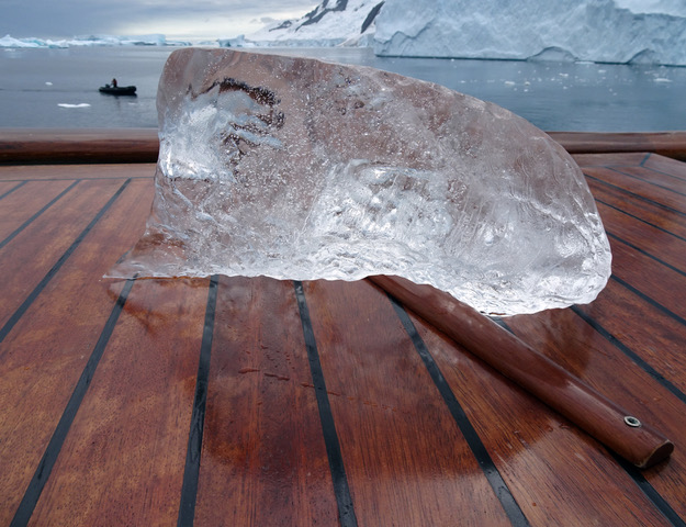
A small chunk of clear glacial ice retrieved from Pléneau Bay, Antarctica.
Source: P. Lobner photo

Where do glaciers exist?

The National Snow and Ice Data Center (NSIDC) reports that, “glaciers occupy about 10 percent of the world’s total land area, with most located in polar regions like Antarctica, Greenland, and the Canadian Arctic. Glaciers can be thought of as remnants from the last Ice Age, when ice covered nearly 32 percent of the land, and 30 percent of the oceans. Most glaciers lie within mountain ranges that show evidence of a much greater extent during the ice ages of the past two million years, and more recent indications of retreat in the past few centuries.”

Glaciers exist on every continent except Australia. The approximate distribution of glaciers is:

  1. 91% in Antarctica
  2. 8% in Greenland
  3. Less than 0.5% in North America (about 0.1% in Alaska)
  4. 0.2% in Asia
  5. Less than 0.1% is in South America, Europe, Africa, New Zealand, and New Guinea (Irian Jaya).

There are several schemes for classifying glaciers; some are described in the references at the end of this article.  For simplicity, let’s consider two basic types.

  1. polar glacier is defined as one that is below the freezing temperature throughout its mass for the entire year.  Polar glaciers exist in Antarctica and Greenland as continental scale ice sheets and smaller scale ice caps and ice fields.
  2. temperate glacier is a glacier that’s essentially at the melting point, so liquid water coexists with glacier ice. A small change in temperature can have a major impact on temperate glacier melting, area, and volume. Glaciers not in Antarctica or Greenland are temperate glaciers.  In addition, some of the glaciers on the Antarctic Peninsula and some of Greenland’s southern outlet glaciers are temperate glaciers.

How old is glacier ice?

Some glacial ice is extremely old, while in many areas of the world, it is much younger than you might have expected.

USGS reports:  “Parts of the Antarctic Continent have had continuous glacier cover for perhaps as long as 20 million years. Other areas, such as valley glaciers of the Antarctic Peninsula and glaciers of the Transantarctic Mountains may date from the early Pleistocene (starting about 2.6 million years ago and lasting until about 11,700 years ago). For Greenland, ice cores and related data suggest that all of southern Greenland and most of northern Greenland were ice-free during the last interglacial period, approximately 125,000 years ago. Then, climate (in Greenland) was as much as 3-5o F warmer than the interglacial period we currently live in.”

“Although the higher mountains of Alaska have hosted glaciers for as much as the past 4 million years, most of Alaska temperate glaciers are generally much, much younger. Many formed as recently as the start of the Little Ice Age, approximately 1,000 years ago. Others may date from other post-Pleistocene (younger than 11,700 years ago) colder climate events.”

  1. The age of the oldest glacier ice in Antarctica may approach 20,000,000 years old.
  2. The age of the oldest glacier ice in Greenland may be more than 100,000 years old, but less than 125,000 years old.
  3. The age of the oldest Alaskan glacier ice ever recovered was about 30,000 years old.

Blue glacial ice along the coast of the West Antarctic Peninsula

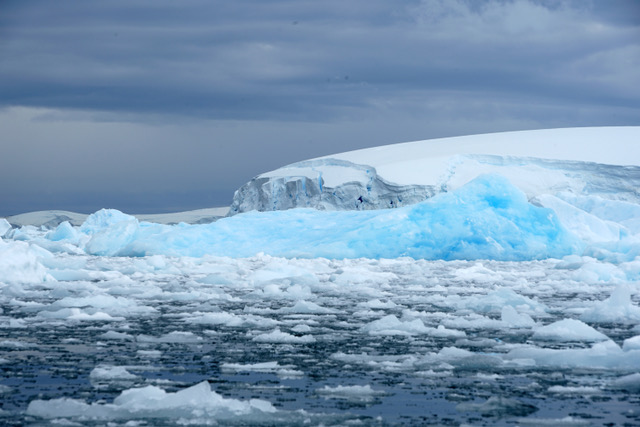
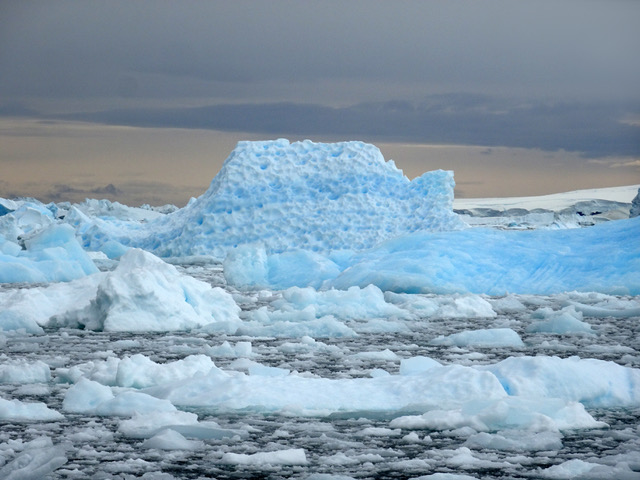
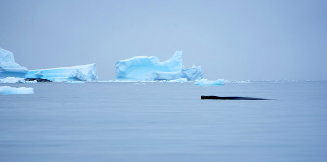
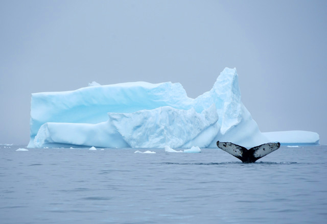
In February 2020, my wife and I made a well-timed visit to the West Antarctic Peninsula.  One particularly amazing spot was Pléneau Bay, which easily could earn the title “Antarctic Museum of Modern Art” because of the many fanciful iceberg shapes floating gently in this quiet bay.  Following is a short photo essay highlighting several of the beautiful blue glacial ice features we saw on this trip.

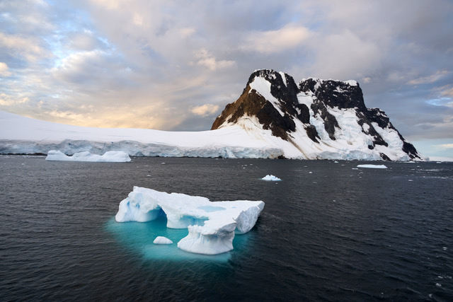
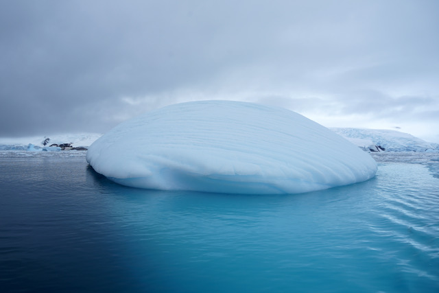
Small blue iceberg in the Lemaire Channel. Source: P. Lobner photo
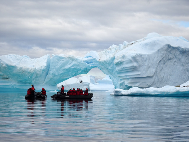
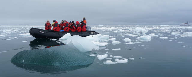
Zodiacs in what could be called the “Antarctic Museum of Modern Art”
 in Pléneau Bay. Source: J. Lobner photo
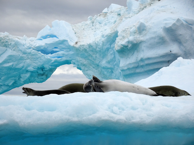
Crabeater seal amid the blue icebergs in Pléneau Bay. 
Source: J. Lobner photo
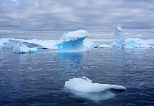
Exotic blue iceberg shapes in Pléneau Bay. Source: P. Lobner photo
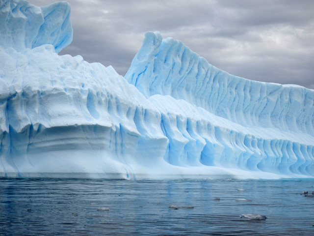
The tall, fluted wall of a large blue iceberg in Pléneau Bay.
Source: J. Lobner photo
A chunk of faceted glacial ice among the brash sea ice in Hanusse Bay / Crystal Sound. Source: P. Lobner photo
Blue icebergs among the brash sea ice at Prospect Point
(above & below). Source: P. Lobner photos
A humpback whale resting among the blue icebergs in Cierva Cove (above) and diving (below). Source: P. Lobner photos
This iceberg (above & below) in Cierva Cove looks like a majestic blue sailing ship. 
Source: P. Lobner photos
Another exotic blue iceberg in Cierva Cove. Source: J. Lobner photo
Zodiac among blue icebergs in Cierva Cove. Source: P. Lobner photo
The large underwater part of this iceberg radiates blue in Cierva Cove.
Source: P. Lobner photo
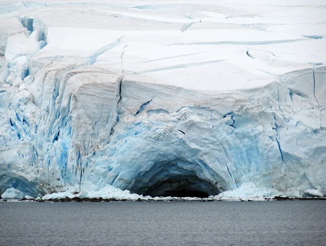
A sea cave provides a view into the blue ice underlying an ice shelf.
Source: P. Lobner photo

Examples of blue glacial ice in Switzerland & New Zealand 

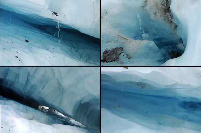
In previous years, my wife and I visited a temperate glacier and ice cave in Grindelwald, Switzerland and hiked on the temperate Franz Josef Glacier on the South Island of New Zealand.  Following is a short photo essay that should give you an idea of the complex terrain of these glaciers and the smaller scale blue ice features visible on the surface.  In contrast, the ice cave was a unique, immersive, very blue experience.  The blue color inside the cave looked like the eerie blue light from Cherenkov radiation, like you’d see in an operating pool-type nuclear research reactor.

Inside a glacial ice cave in Grindelwald, Switzerland.
Source: P. Lobner photo
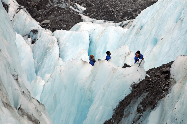
Franz Joseph Glacier showing a general blue tint in some surface ice (above) and more intense blue in smaller areas (below), South Island, 
New Zealand.  Source:  P. Lobner photos
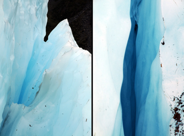
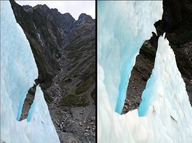
Franz Joseph Glacier details (above & below). 
Source: P. Lobner photos

For more information:

  1. “What is a glacier?” US Geologic Survey (USGS) website:  https://www.usgs.gov/faqs/what-a-glacier?qt-news_science_products=0#qt-news_science_products
  2.  “Why Glacier Ice is Blue,” USGS website: https://www.usgs.gov/faqs/why-glacier-ice-blue?qt-news_science_products=0#qt-news_science_products
  3.  “Common Questions and Myths About Glaciers,” National Park Service (NPS) website: https://www.nps.gov/glba/learn/nature/common-questions-and-myths-about-glaciers.htm
  4. Becky Oskin, “Why Are Some Glaciers Blue?” LiveScience website: https://www.livescience.com/51019-why-is-antarctica-ice-blue.html
  5. Stephen Warren, “Optical properties of ice and snow,” Philosophical Transactions of the Royal Society, 15 April 2019: https://royalsocietypublishing.org/doi/full/10.1098/rsta.2018.0161
  6.  “About Glaciers,” National Snow and Ice Data Center (NSIDC) website: https://nsidc.org/cryosphere/glaciers/information.html
  7. Robin George Andrews, “Icebergs can be emerald green. Now we know why,” National Geographic, 15 March 2019: https://www.nationalgeographic.com/science/2019/03/icebergs-can-be-emerald-green-now-we-know-why

NOAA’s Monthly Climate Summaries are Worth Your Attention

Peter Lobner

The National Oceanic and Atmospheric Administration’s (NOAA’s) National Centers for Environmental Information (NCEI) are responsible for “preserving, monitoring, assessing, and providing public access to the Nation’s treasure of climate and historical weather data and information.”  The main NOAA / NCEI website is here:

https://www.ncdc.noaa.gov

The “State of the Climate” is a collection of monthly summaries recapping climate-related occurrences on both a global and national scale.  Your starting point for accessing this collection is here:

https://www.ncdc.noaa.gov/sotc/

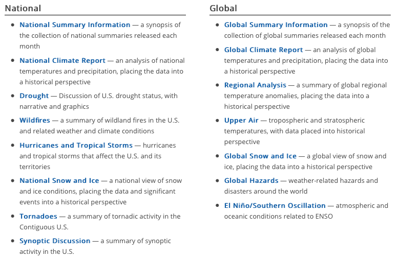
The following monthly summaries are available.

I’d like to direct your attention to two particularly impressive monthly summaries:

  • Global Summary Information, which provides a comprehensive top-level view, including the Sea Ice Index
  • Global Climate Report, which provides more information on temperature and precipitation, but excludes the Sea Ice Index information

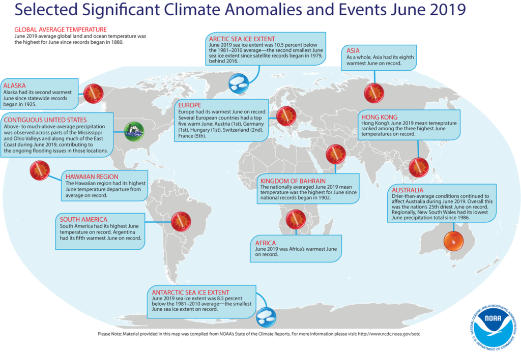
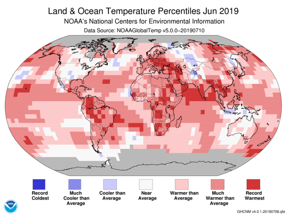
Here are some of the graphics from the Global Climate Report for June 2019.

Source: NOAA NCEI
Source: NOAA NCEI

NOAA offered the following synopsis of the global climate for June 2019.

  • The month of June was characterized by warmer-than-average temperatures across much of the world. The most notable warm June 2019 temperature departures from average were observed across central and eastern Europe, northern Russia, northeastern Canada, and southern parts of South America.
  • Averaged as a whole, the June 2019 global land and ocean temperature departure from average was the highest for June since global records began in 1880.
  • Nine of the 10 warmest Junes have occurred since 2010.

For more details, see the online June 2019 Global Climate Reportat the following link:

https://www.ncdc.noaa.gov/sotc/global/201906

A complementary NOAA climate data resource is the National Snow & Ice Data Center’s (NSIDC’s) Sea Ice Index, which provides monthly and daily quick looks at Arctic-wide and Antarctic-wide changes in sea ice. It is a source for consistently processed ice extent and concentration images and data values since 1979. Maps show sea ice extent with an outline of the 30-year (1981-2010) median extent for the corresponding month or day. Other maps show sea ice concentration and anomalies and trends in concentration.  In addition, there are several tools you can use on this website to animate a series of monthly images or to compare anomalies or trends.  You’ll find the Sea Ice Index here:

https://nsidc.org/data/seaice_index/

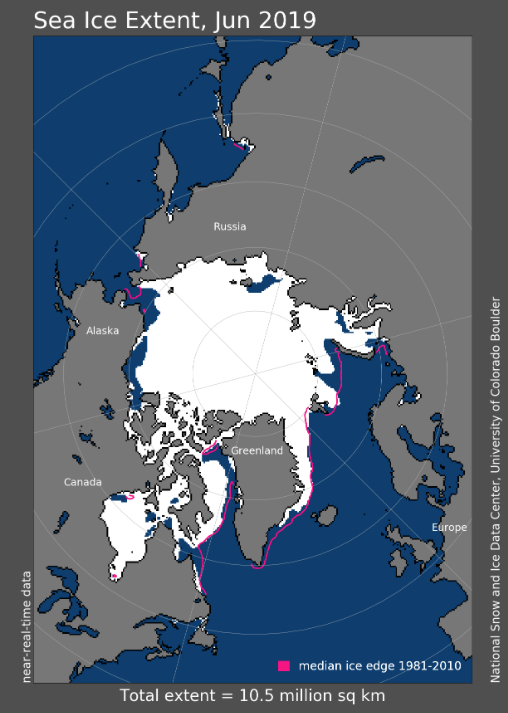
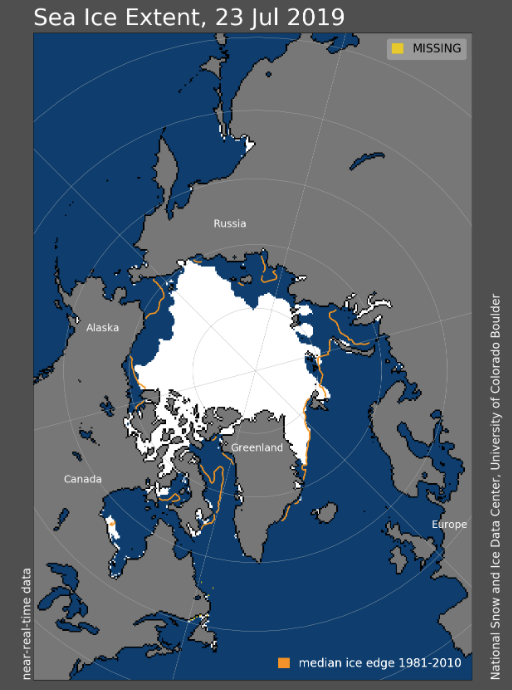
The Arctic sea ice extent for June 2019 and the latest daily results for 23 July 2019 are shown in the following graphics, which show the rapid shrinkage of the ice pack during the Arctic summer.  NOAA reported that the June 2019 Arctic sea ice extent was 10.5% below the 30-year (1981 – 2010) average.  This is the second smallest June Arctic sea ice extent since satellite records began in 1979.

Source:  NOAA NSIDC
Source:  NOAA NSIDC

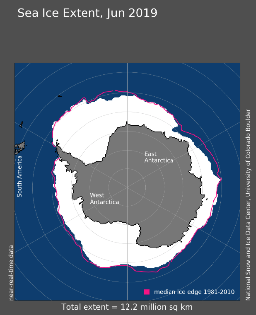
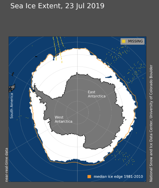
The monthly Antarctic results for June 2019 and the latest daily results for 23 July 2019 are shown in the following graphics, which show the growth of the Antarctic ice pack during the southern winter season. NOAA reported that the June 2019 Antarctic sea ice extent was 8.5% below the 30-year (1981 – 2010) average.  This is the smallest June Antarctic sea ice extent on record.

Source:  NOAA NSIDC
Source:  NOAA NSIDC

I hope you enjoy exploring NOAA’s “State of the Climate” collection of monthly summaries.

Marine Nuclear Power: 1939 – 2018

Peter Lobner

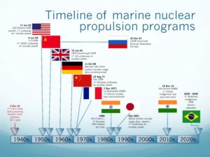
In 2015, I compiled the first edition of a resource document to support a presentation I made in August 2015 to The Lyncean Group of San Diego (www.lynceans.org) commemorating the 60thanniversary of the world’s first “underway on nuclear power” by USS Nautilus on 17 January 1955.  That presentation to the Lyncean Group, “60 years of Marine Nuclear Power: 1955 –2015,” was my attempt to tell a complex story, starting from the early origins of the US Navy’s interest in marine nuclear propulsion in 1939, resetting the clock on 17 January 1955 with USS Nautilus’ historic first voyage, and then tracing the development and exploitation of marine nuclear power over the next 60 years in a remarkable variety of military and civilian vessels created by eight nations.

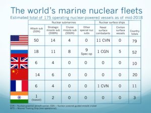
Here’s a quick overview of worldwide marine nuclear in 2018.

Source: two charts by author

In July 2018, I finished a complete update of the resource document and changed the title to, “Marine Nuclear Power: 1939 –2018.”  Due to its present size (over 2,100 pages), the resource document now consists of the following parts, all formatted as slide presentations:

  • Part 1: Introduction
  • Part 2A: United States – Submarines
  • Part 2B: United States – Surface Ships
  • Part 3A: Russia – Submarines
  • Part 3B: Russia – Surface Ships & Non-propulsion Marine Nuclear Applications
  • Part 4: Europe & Canada
  • Part 5: China, India, Japan and Other Nations
  • Part 6: Arctic Operations

The original 2015 resource document and this updated set of documents were compiled from unclassified, open sources in the public domain.

I acknowledge the great amount of work done by others who have published material in print or posted information on the internet pertaining to international marine nuclear propulsion programs, naval and civilian nuclear powered vessels, naval weapons systems, and other marine nuclear applications.  My resource document contains a great deal of graphics from many sources.  Throughout the document, I have identified the sources for these graphics.

You can access all parts of Marine Nuclear Power: 1939 – 2018 here:

Marine Nuclear Power 1939 – 2018_Part 1_Introduction

Marine Nuclear Power 1939 – 2018_Part 2A_USA_submarines

Marine Nuclear Power 1939 – 2018_Part 2B_USA_surface ships

Marine Nuclear Power 1939 – 2018_Part 3A_R1_Russia_submarines

Marine Nuclear Power 1939 – 2018_Part 3B_R1_Russia_surface ships & non-propulsion apps

Marine Nuclear Power 1939 – 2018_Part 4_Europe & Canada

Marine Nuclear Power 1939 – 2018_Part 5_China-India-Japan & Others

Marine Nuclear Power 1939 – 2018_Part 6 R1_Arctic marine nuclear

I hope you find this resource document informative, useful, and different from any other single document on this subject.  Below is an outline to help you navigate through the document.

Outline of Marine Nuclear Power:  1939 – 2018.

Part 1: Introduction

  • Quick look:  Then and now
  • State-of-the-art in 1955
  • Marine nuclear propulsion system basics
  • Timeline
    • Timeline highlights
    • Decade-by-decade
  • Effects of nuclear weapons and missile treaties & conventions on the composition and armament of naval fleets
  • Prospects for 2018 – 2030

Part 2A: United States – Submarines

  • Timeline for development of marine nuclear power in the US
  • US current nuclear vessel fleet
  • US naval nuclear infrastructure
  • Use of highly-enriched uranium (HEU) in US naval reactors
  • US submarine reactors and prototype facilities
  • US Navy nuclear-powered submarines
    • Nuclear-powered fast attack submarines (SSN)
      • Submarine-launched torpedoes, anti-submarine missiles & mines
      • Systems to augment submarine operational capabilities
    • Nuclear-powered strategic ballistic missile submarines (SSBN)
      • Submarine-launched strategic ballistic missiles (SLBMs)
    • Nuclear-powered guided missile submarines (SSGN)
      • Cruise missiles and other tactical guided missiles
    • Nuclear-powered special operations submarines

Part 2B: United States – Surface Ships

  • US naval surface ship reactors & prototype facilities
  • US Navy nuclear-powered surface ships
    • Evolution of the US nuclear-powered surface fleet
    • Nuclear-powered guided missile cruisers (CGN)
      • CGN tactical weapons
    • Nuclear-powered aircraft carriers (CVN)
      • Carrier strike group (CSG) & carrier air wing composition
  • Naval nuclear vessel decommissioning and nuclear waste management
  • US civilian marine nuclear vessels and reactors
    • Operational & planned civilian marine vessels and their reactors
    • Other US civilian marine reactor designs
  • Radioisotope Thermoelectric Generator (RTG) marine applications
  • US marine nuclear power current trends

Part 3A: Russia – Submarines

  • The beginning of the Soviet / Russian marine nuclear power program
  • Russian current nuclear vessel fleet.
  • Russian marine nuclear reactor & fuel-cycle infrastructure
  • Russian nuclear vessel design, construction & life-cycle infrastructure
  • Russian naval nuclear infrastructure
  • Russian nuclear-powered submarines
    • Submarine reactors
    • Nuclear-powered fast attack submarines (SSN)
      • Submarine-launched torpedoes & anti-submarine missiles
    • Strategic ballistic missile submarines (SSB & SSBN)
      • Submarine-launched ballistic missiles (SLBM)
    • Cruise missile submarines (SSG & SSGN).
      • Cruise missiles
    • Nuclear-powered special operations subs & strategic torpedoes
    • Other special-purpose nuclear-powered subs
    • Examples of un-built nuclear submarine projects

Part 3B: Russia – Surface Ships & Non-propulsion Marine Nuclear Applications

  • Russian nuclear-powered surface ships
    • Surface ship reactors
    • Nuclear-powered icebreakers
    • Nuclear-powered naval surface ships
      • Nuclear-powered guided missile cruisers
      • Nuclear-powered command ship
      • Nuclear-powered aircraft carrier
      • Nuclear-powered multi-purpose destroyer
  • Russian non-propulsion marine nuclear applications
    • Small reactors for non-propulsion marine nuclear applications
    • Floating nuclear power plants (FNPP)
    • Transportable reactor units (TRU)
    • Arctic seabed applications for marine nuclear power
    • Radioisotope Thermoelectric Generators (RTG)
  • Marine nuclear decommissioning and environmental cleanup
  • Russian marine nuclear power current trends

Part 4: Europe & Canada

  • Nations that operate or have operated nuclear vessels
    • United Kingdom
      • The beginning of the UK marine nuclear power program
      • UK current nuclear vessel fleet
      • UK naval nuclear infrastructure
      • UK naval nuclear reactors
      • UK Royal Navy nuclear-powered submarines
        • Nuclear-powered fast attack submarines (SSN)
          • Submarine-launched tactical weapons
        • Nuclear-powered strategic ballistic missile submarines (SSBN)
          • Submarine-launched ballistic missiles (SLBM)
      • UK disposition of decommissioned nuclear submarines
      • UK nuclear surface ship and marine reactor concepts
      • UK marine nuclear power current trends
    • France
      • The beginning of the French marine nuclear power program
      • French current nuclear vessel fleet
      • French naval nuclear infrastructure
      • French naval nuclear reactors
      • French naval nuclear vessels
        • Nuclear-powered strategic ballistic missile submarines (SNLE)
          • Submarine-launched ballistic missiles (MSBS)
        • Nuclear-powered fast attack submarines (SNA)
          • Submarine-launched tactical weapons
        • Nuclear-powered aircraft carrier
      • French disposition of decommissioned nuclear submarines
      • French non-propulsion marine reactor applications
      • French marine nuclear power current trends
    • Germany
  • Other nations with an interest in marine nuclear power technology
    • Italy
    • Sweden
    • Netherlands
    • Canada

Part 5: China, India, Japan and Other Nations

  • Nations that have operated nuclear vessels
    • China
      • The beginning of China’s marine nuclear power program
      • China’s current nuclear vessel fleet
      • China’s naval nuclear infrastructure
      • China’s nuclear vessels
        • Nuclear-powered fast attack submarines (SSNs)
          • Submarine-launched tactical weapons
        • Nuclear-powered strategic ballistic missile subs (SSBNs)
          • Submarine-launched ballistic missiles (SLBMs)
        • Floating nuclear power stations
        • Nuclear-powered surface ships
      • China’s decommissioned nuclear submarine status
      • China’s marine nuclear power current trends
    • India
      • The beginning of India’s marine nuclear power program
      • India’s current nuclear vessel fleet
      • India’s naval nuclear infrastructure
      • India’s nuclear-powered submarines
        • Nuclear-powered fast attack submarines (SSNs)
          • Submarine-launched tactical weapons
        • Nuclear-powered strategic ballistic missile submarines (SSBNs)
          • Submarine-launched ballistic missiles (SLBM).
      • India’s marine nuclear power current trends
    • Japan
  • Other nations with an interest in marine nuclear power technology
    • Brazil
    • North Korea
    • Pakistan
    • Iran
    • Israel
    • Australia

Part 6: Arctic Operations

  • Rationale for marine nuclear power in the Arctic
  • Orientation to the Arctic region
  • US Arctic policy
  • Dream of the Arctic submarine
  • US marine nuclear Arctic operations
  • UK marine nuclear Arctic operations
  • Canada marine nuclear ambitions
  • Russian marine nuclear Arctic operations
    • Russian non-propulsion marine nuclear Arctic applications
  • China’s marine nuclear ambitions
  • Current trends in marine nuclear Arctic operations

Periodic updates:

  • Parts 3A and 3B, Revision 1, were posted in October 2018
  • Part 6, Revision 1, was posted in February 2019

You Need to Know About Russia’s Main Directorate of Deep-Sea Research (GUGI)

Peter Lobner

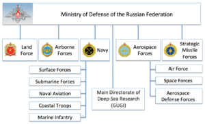
The Main Directorate of Deep-Sea Research, also known as GUGI and Military Unit 40056, is an organizational structure within the Russian Ministry  of Defense that is separate from the Russian Navy.  The Head of GUGI is Vice-Admiral Aleksei Burilichev, Hero of Russia.

Source. Adapted from Ministry of Defense of the Russian Federation, http://eng.mil.ru/en/index.htm

Vice-Admiral Aleksei Burilichev at the commissioning of GUGI oceanographic research vessel Yantar. Source: http://eng.mil.ru/

GUGI is responsible for fielding specialized submarines, oceanographic research ships, undersea drones and autonomous vehicles, sensor systems, and other undersea systems.   Today, GUGI operates the world’s largest fleet of covert manned deep-sea vessels. In mid-2018, that fleet consisted of eight very specialized nuclear-powered submarines.

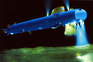
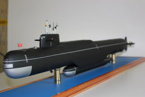
There are six nuclear-powered, deep-diving, small submarines (“nuclear deep-sea stations”), each of which is capable of working at great depth (thousands of meters) for long periods of time.  These subs are believed to have diver lockout facilities to deploy divers at shallower depths.

  • One Project 1851 / 18510 Nelma (aka X-Ray) sub delivered in 1986; Length: 44 m (144.4 ft.); displacement about 529 tons submerged. This is the first and smallest of the Russian special operations nuclear-powered submarines.
  • Two Project 18511 Halibut (aka Paltus) subs delivered between 1994 – 95; Length: 55 m (180.4 ft.); displacement about 730 tons submerged.
  • Three Project 1910 Kashalot (aka Uniform) subs delivered between 1986 – 1991, but only two are operational in 2018; Length: 69 m (226.4 ft.); displacement about 1,580 tons submerged.
  • One Project 09851 Losharik (aka NORSUB-5) sub delivered in about 2003; Length: 74 m (242.8 ft.); displacement about 2,100 tons submerged.

The trend clearly is toward larger, and certainly more capable deep diving special operations submarines.  The larger subs have a crew complement of 25 – 35.

Kashalot notional cross-section diagram. Source: adapted from militaryrussia.ru

Kashalot notional diagram showing deployed positioning thrusters, landing legs and tools for working on the bottom. Source: http://nvs.rpf.ru/nvs/forum
The Russian small special operations subs may have been created in response to the U.S. Navy’s NR-1 small, deep-diving nuclear-powered submarine, which entered service in 1969.  NR-1 had a length of 45 meters (147.7 ft.) and a displacement of about 400 tons submerged, making it roughly comparable to the Project 1851 / 18510 Nelma . NR-1 was retired in 2008, leaving the U.S. with no counterpart to the Russian fleet of small, nuclear-powered special operations subs.

GUGI operates two nuclear-powered “motherships” (PLA carriers) that can transport one of the smaller nuclear deep-sea stations to a distant site and provide support throughout the mission. The current two motherships started life as Delta III and Delta IV strategic ballistic missile submarines (SSBNs).  The original SSBN missile tubes were removed and the hulls were lengthened to create large midship special mission compartments with a docking facility on the bottom of the hull for one of the small, deep-diving submarines.  These motherships probably have a test depth of about 250 to 300 meters (820 to 984 feet).  They are believed to have diver lockout facilities for deploying divers.

General arrangement of a Russian mothership carrying a small special operations submarine.  Source:  http://gentleseas.blogspot.com/2015/08/russias-own-jimmy-carter-special-ops.html
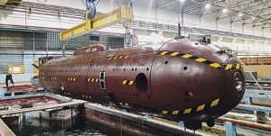
Delta-IV mothership carrying Losharik.  Source: GlobalSecurity.org

The motherships also are believed capable of deploying and retrieving a variety of  autonomous underwater vehicles (AUVs), including the relatively large Harpsichord: Length: 6.5 m (21.3 ft.); Diameter 1 m (3.2 ft.); Weight: 3,700 kg (8,157 pounds).

Harpsichord-2R-PM. Source: http://vpk-news.ru/articles/30962
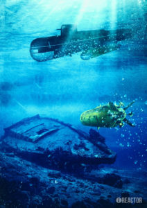
The following graphic shows a mothership carrying a small special operations sub  while operating with a Harpsichord AUV.

                       Source: https://russianmilitaryanalysis.wordpress.com/tag/9m730/
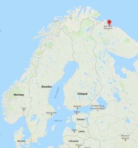
These nuclear submarines are operated by the 29th Special Submarine Squadron, which is based along with other GUGI vessels at Olenya Bay, in the Kola Peninsula on the coast of the Barents Sea.

Olenya Bay is near Murmansk.  Source: Google Maps
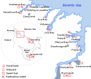
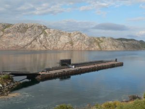
Russian naval facilities near Murmansk.  Source: https://commons.wikimedia.org

Mothership BS-136 Orenburg at Oleyna Bay.  Source: Source: http://www.air-defense.net/
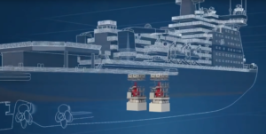
The GUGI fleet provides deep ocean and Arctic operating capabilities that greatly exceed those of any other nation.  Potential missions include:

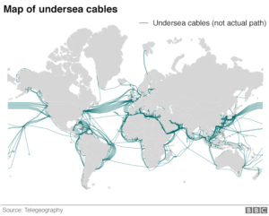
  • Conducting subsea surveys, mapping and sampling (i.e., to help validate Russia’s extended continental shelf claims in the Arctic; to map potential future targets such as seafloor cables)
  • Placing and/or retrieving items on the sea floor (i.e., retrieving military hardware, placing subsea power sources, power distribution systems and sonar arrays)
  • Maintaining military subsea equipment and systems
  • Conducting covert surveillance
  • Developing an operational capability to deploy the Poseidon strategic nuclear torpedo.
  • In time of war, attacking the subsea infrastructure of other nations in the open ocean or in the Arctic (i.e., cutting subsea internet cables, power cables or oil / gas pipelines)

Analysts at the firm Policy Exchange reported that the world’s undersea cable network comprises about 213 independent cable systems and 545,018 miles (877,121 km) of fiber-optic cable.  These undersea cable networks carry an estimated 97% of global communications and $10 trillion in daily financial transactions are transmitted by cables under the ocean.

Since about 2015, NATO has observed Russian vessels stepping up activities around undersea data cables in the North Atlantic. None are known to have been tapped or cut.  Selective attacks on this cable infrastructure could electronically isolate and severely damage the economy of individual countries or regions.  You’ll find a more detailed assessment on this matter in the 15 December 2017 BBC article, “Russia a ‘risk’ to undersea cables, Defence chief warns.”

http://www.bbc.com/news/uk-42362500

GUGI also is responsible for the development of the Poseidon (formerly known as Status-6 / Kanyon) strategic nuclear torpedo and the associated “carrier” submarines.

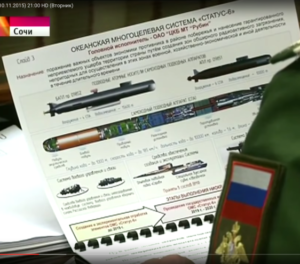
Poseidon, which was first revealed on Russian TV in November 2015,  is a large, nuclear-powered, autonomous underwater vehicle (AUV) that functionally is a giant, long-range torpedo.

 The Russian TV “reveal” of the Oceanic Multipurpose System Status-6 November 2015. Source: https://russianmilitaryanalysis.wordpress.com/tag/9m730/
It is capable of delivering a very large nuclear warhead (perhaps up to 100 MT) underwater to the immediate proximity of an enemy’s key economic and military facilities in coastal areas.  It is a weapon of unprecedented destructive power and it is not subject to any existing nuclear arms limitation treaties. However, its development would give Russia leverage in future nuclear arms limitation talks.

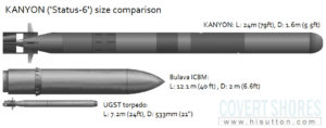
The immense physical size of the Poseidon strategic nuclear torpedo is evident in the size comparison chart below.

Source: http://www.hisutton.com/
The Bulava is the Russian submarine launched ballistic missile (SLBM) carried on Russia’s modern Borei-class SSBNs.  The UGST torpedo is representative of a typical torpedo launched from a 533 mm (21 inch) torpedo tube, which is found on the majority of submarines in the world.  An experimental submarine, the B-90 Sarov, appears to be the current testbed for the Poseidon strategic torpedo.  Russia is building other special submarines to carry several Poseidon strategic torpedoes.  One is believed to be the giant, highly modified Oscar II submarine K-139 Belgorod, which also will serve as a mothership for a small, special operations nuclear sub.  The other is the smaller Project 09851 submarine Khabarovsk, which appears to be purpose-built for carrying the Poseidon.

For more information on GUGI, Russian special operations submarines and other covert underwater projects, refer to the Covert Shores website created by naval analyst H. I. Sutton, which you’ll find at the following link:

http://www.hisutton.com/Analysis%20-%20Russian%20Status-6%20aka%20KANYON%20nuclear%20deterrence%20and%20Pr%2009851%20submarine.html

Significant Progress has Been Made in Implementing the Arctic Council’s Arctic Marine Strategic Plan (AMSP)

Peter Lobner

The Arctic Council describes itself as, “….the leading intergovernmental forum promoting cooperation, coordination and interaction among the Arctic States, Arctic indigenous communities and other Arctic inhabitants on common Arctic issues, in particular on issues of sustainable development and environmental protection in the Arctic.” The council consists of representatives from the eight Arctic states:

  • Canada,
  • Kingdom of Denmark (including Greenland and the Faroe Islands)
  • Finland
  • Iceland
  • Norway
  • Russia
  • Sweden
  • United States

In addition, six international organizations representing Arctic indigenous people have permanent participant status. You’ll find the Arctic Council’s website at the following link:

http://www.arctic-council.org/index.php/en/

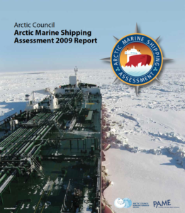
One outcome of the Arctic Council’s 2004 Senior Arctic Officials (SAO) meeting in Reykjavik, Iceland was a call for the Council’s Protection of the Arctic Marine Environment (PAME) working group to conduct a comprehensive Arctic marine shipping assessment as outlined in the AMSP. The key result of that effort was The Arctic Marine Shipping Assessment 2009 Report (AMSA), which you can download here:

https://oaarchive.arctic-council.org/handle/11374/54

Source: Arctic Council

This report provided a total of 17 summary recommendations for Arctic states in the following three areas:

I. Enhancing Arctic marine safety

A. Coordinating with international organizations to harmonize a regulatory framework for Arctic maritime safety.

B. Supporting International Maritime Organization (IMO) standards for vessels operating in the Arctic.

C. Developing uniform practices for Arctic shipping governance, including in areas of the central Arctic ocean that are beyond the jurisdiction of any Arctic state.

D. Strengthening passenger ship safety in Arctic waters

E. Supporting development of a multi-national Arctic search and rescue capability.

II. Protecting Arctic people and the environment

A. Conducting surveys of Arctic marine use by indigenous people

B. Ensuring effective engagement with Arctic coastal communities

C. Identifying and protecting areas of heightened ecological and cultural significance.

D. Where appropriate, designating “Special Areas” or “Particularly Sensitive Areas”

E. Protecting against introduction of invasive species

F. Preventing oil spills

G. Determining impacts on marine animals and take mitigating actions

H. Reducing air emissions (CO2, NOx, SO2 and black carbon particles)

III. Building the Arctic marine infrastructure

A. Improving the Arctic infrastructure to support development while enhancing safety and protecting the Arctic people and environment, including icebreakers to assist in response.

B. Developing a comprehensive Arctic marine traffic awareness system and cooperate in development of national monitoring systems.

C. Developing a circumpolar environmental response capability.

D. Investing in hydrographic, meteorological and oceanographic data needed to support safe navigation and voyage planning.

The AMSA 2009 Report is a useful resource, with thorough descriptions and findings related to the following:

  • Arctic marine geography, climate and sea ice
  • History of Arctic marine transport
  • Governance of Arctic shipping
  • Current marine use and the AMSA shipping database
  • Scenarios, futures and regional futures to 2020 (Bering Strait, Canadian Arctic, Northern Sea Route)
  • Human dimensions (for a total Arctic population of about 4 M)
  • Environmental considerations and impacts
  • Arctic marine infrastructure

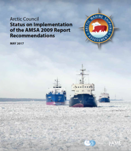
Four status reports from 2011 to 2017 documented the progress by Arctic states in implementing the 17 summary recommendations in AMSA 2009. The fourth and final progress report entitled, “Status of Implementation of the AMSA 2009 Report Recommendations; May 2017,” is available at the following link:

https://www.isemar.fr/wp-content/uploads/2017/09/Conseil-de-Arctic-rapport-Arctic-Marine-Shipping-Assessment-AMSA-mai-2017.pdf

Source: Arctic Council

Through PAME and other working groups, the Arctic Council will continue its important role in implementing the Arctic Marine Strategic Plan. You can download the current version of that plan, for the period from 2015 – 2025, here:

https://oaarchive.arctic-council.org/handle/11374/413

Source: Arctic Council

For example, on 6 November 2017, the Arctic Council will host a session entitled, “The global implications of a rapidly-changing Arctic,” at the UN Climate Change Conference COP23 meeting in Bonn, Germany. For more information on this event, use this link:

http://www.arctic-council.org/index.php/en/our-work2/8-news-and-events/473-cop23

The Sad State of Affairs of the U.S. Polar Icebreaking Fleet, Revisited

Updated 4 January 2019

Peter Lobner

In my 9 September 2015 post, I reviewed the current state of the U.S. icebreaking fleet. My closing comments were:

“The U.S. is well behind the power curve for conducting operations in the Arctic that require icebreaker support.  Even with a well-funded new U.S. icebreaker construction program, it will take a decade before the first new ship is ready for service, and by that time, it probably will be taking the place of Polar Star, which will be retiring or entering a more comprehensive refurbishment program.”

You can read my 2015 post here:

https://lynceans.org/all-posts/the-sad-state-of-affairs-of-the-u-s-icebreaking-fleet-and-implications-for-future-u-s-arctic-operations/

Alternatives for modernizing existing U.S. polar icebreakers to extend their operating lives and options for procuring new polar icebreakers were described in the Congressional Research Service report, “Coast Guard Polar icebreaker Modernization: Background and Issues for Congress,” dated 2 September 2015. You can download that report here:

https://news.usni.org/wp-content/uploads/2015/09/RL34391.pdf

While the Coast Guard Authorization Act of 2015 made funds available for “pre-acquisition” activities for a new polar icebreaker, little action has been taken to start procuring new polar icebreakers for the USCG. This Act required the Secretary of the Department of Homeland Security (DHS) to engage the National Academies (ironically, not the Coast Guard) in “an assessment of alternative strategies for minimizing the costs incurred by the federal government in procuring and operating heavy polar icebreakers.”

The DHS and USCG issued the “Coast Guard Mission Needs Statement,” on 8 January 2016 as a report to Congress. This report briefly addressed polar ice operations in Section 11 and in Appendix B acknowledged two key roles for polar icebreakers:

  • The USCG provides surface access to polar regions for all Department of Defense (DoD) activities and logistical support for remote operating facilities.
  • The USCG supports the National Science Foundation’s research activities in Antarctica by providing heavy icebreaking support of the annual re-supply missions to McMurdo Sound. Additionally, USCG supports the annual NSF scientific mission in the Arctic.

This report to Congress failed to identify deficiencies in the USCG polar icebreaker “fleet” relative to these defined missions (i.e., the USCG has only one operational, aging heavy polar icebreaker) and was silent on the matter of procuring new polar icebreakers. You can download the 2016 “Coast Guard Mission Needs Statement” here:

https://www.dhs.gov/sites/default/files/publications/United%20States%20Coast%20Guard%20-%20Mission%20Needs%20Statement%20FY%202015.pdf

On 22 February 2017, the USCG made some progress when it awarded five, one-year, firm fixed-price contracts with a combined value of $20 M for heavy polar icebreaker design studies and analysis. The USCG reported that, “The heavy polar icebreaker integrated program office, staffed by Coast Guard and U.S. Navy personnel, will use the results of the studies to refine and validate the draft heavy polar icebreaker system specifications.” The USCG press release regarding this modest design study procurement is here:

http://mariners.coastguard.dodlive.mil/2017/02/23/2222017-five-firm-fixed-price-contracts-awarded-for-heavy-polar-icebreaker-design-studies-analysis/

The National Academies finally issued their assessment of U.S. polar icebreaker needs in a letter report to the Secretary of Homeland Security dated 11 July 2017. The report, entitled, “Acquisition and Operation of Polar Icebreakers: Fulfilling the Nation’s Needs.” offered the following findings and recommendations:

  1. Finding: The United States has insufficient assets to protect its interests, implement U.S. policy, execute its laws, and meet its obligations in the Arctic and Antarctic because it lacks adequate icebreaking capability.
  2. Recommendation: The United States Congress should fund the construction of four polar icebreakers of common design that would be owned and operated by the United States Coast Guard (USCG).
  3. Recommendation: USCG should follow an acquisition strategy that includes block buy contracting with a fixed price incentive fee contract and take other measures to ensure best value for investment of public funds.
  4. Finding: In developing its independent concept design and cost estimates, the committee determined that the cost estimated by USCG for the heavy icebreakers are reasonable (average cost per ship of about $791 million for a 4-ship buy).
  5. Finding: Operating costs of new polar icebreakers are expected to be lower than those of the vessels they replace.
  6. Recommendation: USCG should ensure that the common polar icebreaker design is science ready and that one of the ships has full science capability. (This means that the design includes critical features and structures that cannot be cost-effectively retrofit after construction).
  7. Finding: The nation is at risk of losing its heavy icebreaking capability – experiencing a critical capacity gap – as the Polar Star approaches the end of its extended service life, currently estimated to be 3 to 7 years (i.e., sometime between 2020 and 2024).
  8. Recommendation: USCG should keep the Polar Star operational by implementing an enhanced maintenance program (EMP) until at least two new polar icebreakers are commissioned.

You can download this National Academies letter report here:

https://www.nap.edu/catalog/24834/acquisition-and-operation-of-polar-icebreakers-fulfilling-the-nations-needs

There has been a long history of studies that have shown the need for additional U.S. polar icebreakers. This National Academies letter report provides a clear message to DHS and Congress that action is needed now.

In the meantime, in Russia:

To help put the call to action to modernize and expand the U.S. polar icebreaking capability in perspective, let’s take a look at what’s happening in Russia.

The Russian state-owned nuclear icebreaker fleet operator, Rosatomflot, is scheduled to commission the world’s largest nuclear-powered icebreaker in 2019. The Arktika is the first of the new Project 22220 LK-60Ya class of nuclear-powered polar icebreakers being built to replace Russia’s existing, aging fleet of nuclear icebreakers. The LK-60Ya is a dual-draught design that enables these ships to operate as heavy polar icebreakers in Arctic waters and also operate in the shallower mouths of polar rivers. Vessel displacement is about 37,000 tons (33,540 tonnes) with water ballast and about 28,050 tons (25,450 tonnes) without water ballast. When ballasted, LK-60Ya icebreakers will be able to operate in Arctic ice of any thickness up to 4.5 meters (15 feet).

The principal task for the new LK-60Ya icebreakers will be to clear passages for ship traffic on the Northern Sea route, which runs along the Russian Arctic coast from the Kara Sea to the Bering Strait. The second and third ships in this class, Sibir and Ural, are under construction at the Baltic Shipyard in St. Petersburg and are expected to enter service in 2020 and 2021, respectively.

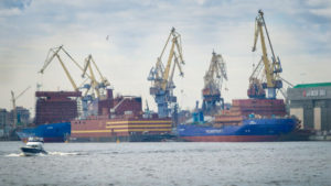
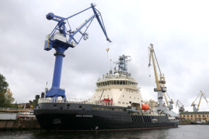
Arktika (on right), Akademik Lomonosov floating nuclear power plant (center), and Sibir (on left) dockside at Baltic Shipyard, St. Petersburg, Russia, October 2017: Source: Charles Diggers / maritime-executive.com

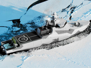
In June 2016, Russia launched the first of four diesel-electric powered 6,000 ton Project 21180 icebreakers at the Admiralty Shipyard in St. Petersburg. The Ilya Muromets, which is expected to be delivered in November 2017, will be the Russian Navy’s first new military icebreaker in about 50 years. It is designed to be capable of breaking ice with a thickness up to 1 meter (3.3 feet). The Project 21180 icebreaker’s primary mission is to provide icebreaking services for the Russian naval forces deployed in the Arctic region and the Far East. The U.S. has no counterpart to this class of Arctic vessel.

Project 21180 military icebreaker Ilya Muromets. Source: The Baltic Post

You’ll find more information on Russia’s Project 21180-class icebreakers here:

http://www.naval-technology.com/projects/project-21180-class-icebreakers/

Russia’s 7,000 – 8,500 ton diesel-electric Project 23550 military icebreaking patrol vessels (corvettes) will be armed combatant vessels capable of breaking ice with a thickness up to 1.7 meters (5.6 feet). The keel for the lead ship, Ivan Papanin, was laid down at the Admiralty Shipyard in St. Petersburg on 19 April 2017. Construction time is expected to be about 36 month, with Ivan Papanin being commissioned in 2020. The second ship in this class should enter service about one year later. Both corvettes are expected to be armed with a mid-size naval gun (76 mm to 100 mm have been reported), containerized cruise missiles, and an anti-submarine capable helicopter (i.e., Kamov Ka-27 type). The U.S. has no counterpart to this class of Arctic vessel.

Project 23550 icebreaking patrol vessel. Source: naval-technology.com

You’ll find more information on Russia’s Project 23550-class icebreaking patrol vessels here:

http://www.naval-technology.com/projects/ivan-papanin-project-23550-class-arctic-patrol-vessels/

In conclusion:

It appears to me that Russia and the U.S. have very different visions for how they will conduct and support future civilian and military operations that require surface access in the Arctic region. The Russians currently have a strong polar icebreaking capability to support its plans for Arctic development and operation, and that capability is being modernized with a new fleet of the world’s largest nuclear-powered icebreakers. In addition, two smaller icebreaking vessel classes, including an icebreaking combatant vessel, soon will be deployed to support Russia’s military in the Arctic and Far East.

In comparison, the U.S. polar icebreaking capability continues to hang by a thread (i.e., the Polar Star) and our nation has to decide if it is even going to show up for polar icebreaking duty in the Arctic in the near future. The U.S. also is a no-show in the area of dedicated military icebreakers, including Arctic-capable armed combatant surface vessels.

Where do you think this Arctic imbalance is headed?

Update: 4 January 2019

In September 2018, the Coast Guard renamed its New Icebreaker Program ‘Polar Security Cutter.’  The hull designation will be WMSP. W is the standard prefix for Coast Guard vessels, and MSP stands for Maritime Security-Polar.  However, the revised designation does not alter how the vessel is funded.

10 December 2018 report by the Congressional Research Service, “Coast Guard Polar Security Cutter (Polar Icebreaker) Program: Background and Issues for Congress,” which you’ll find at the following link: https://fas.org/sgp/crs/weapons/RL34391.pdf

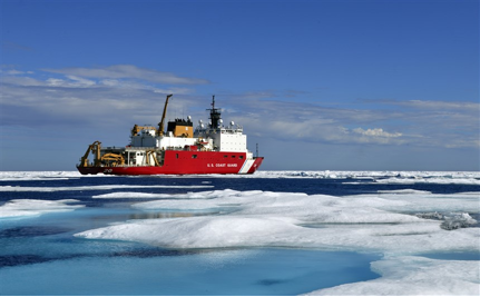
With the heavy polar icebreaker Polar Star (WAGB-10) used exclusively to support Antarctic operations, the medium-size cutter Healy (WAGB-20) is the only Coast Guard polar icebreaker serving the Arctic region. Healy was built in 2000 primarily as an Arctic research vessel for the national Academy of Sciences.

“HEALY is designed to conduct a wide range of research activities, providing more than 4,200 square feet of scientific laboratory space, numerous electronic sensor systems, oceanographic winches, and accommodations for up to 50 scientists. HEALY is designed to break 4.5 feet of ice continuously at three knots and can operate in temperatures as low as -50 degrees F. The science community provided invaluable input on lab layouts and science capabilities during design and construction of the ship. At a time when scientific interest in the Arctic Ocean basin is intensifying, HEALY substantially enhances the United States Arctic research capability.

As a Coast Guard cutter, HEALY is also a capable platform for supporting other potential missions in the polar regions, including logistics, search and rescue, ship escort, environmental protection, and enforcement of laws and treaties.”

Coast Guard cutter Healy: Source: U.S. Coast Guard Pacific Area / Petty Officer 2nd Class Matthew Masaschi

Manufacturing the Reactor Vessel for an RITM-200 PWR for Russia’s new LK-60 Class of Polar Icebreakers

Peter Lobner

The first ship in the new LK-60 class of nuclear powered icebreakers, named Arktika, was launched on 16 June 2016 at the Baltic Shipyard in St. Petersburg, Russia. LK-60 class icebreakers are powered by two RITM-200 integral pressurized water reactors (PWR), each rated at 175 MWt, and together delivering 60 MW (80,460 hp) to an electric motor propulsion system driving three shafts.

LK-60 class icebreakers are the most powerful icebreakers in the world. Contracts for two additional LK-60 icebreakers were placed in May 2014. They are scheduled for delivery in 2020 (Sibr) & 2021 (Ural).

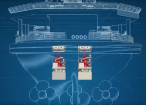
The general arrangement of the nuclear reactors in these ships is shown in the following two diagrams.

Two RITM-200 reactors installed on an LK-60 class icebreaker. Source: Atomenergomash

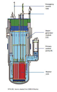
The basic design of the RITM-200 integral primary system is shown in the following diagram. The reactor and steam generators are in the same vessel. The four primary pumps are connected directly to the reactor vessel, creating a very compact primary system unit.

The two reactor vessels were installed in Arktika in September 2016, which is scheduled to be service-ready in mid-2019, and will operate from the Atomflot icebreaker port in Murmansk. Manufacturing of the reactor vessels for the second LK-60 icebreaker, Sibr, is in progress.

Above: Second integral reactor vessel for Arktika, with the primary pump housings installed. Source: Rosatom

Below: Integral reactor vessel at an earlier stage of manufacturing for Sibr.  Source: Atomenergomash

Below: Complete RITM-200 integral reactor vessel. Source: Atomenergomash

You can watch an Atomenergomash video (in Russian) showing how the RITM-200 reactor vessel is manufactured at the following link:

The U.S. has no nuclear powered icebreakers and only one, older polar-class icebreaker. See my 3 September 2015, “The Sad State of Affairs of the U.S. Icebreaking Fleet and Implications for Future U.S. Arctic Operations,” for more information on the U.S. icebreaker fleet.

2016 Arctic Sea Ice Minimum Was Second Lowest on Record

Peter Lobner

On 15 September 2016, the National Snow and Ice Data Center (NSIDC) in Boulder, CO reported their preliminary assessment that the Arctic sea ice minimum for this year was reached on 10 September 2016.

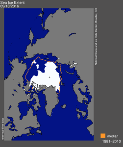
Arctic sea ice minimum 10Sep2016Source: NSIDC

The minimum extent of the Arctic sea ice on 10 September 2016 was 4.14 million square kilometers (1.60 million square miles). This is the white area in the map above. The orange line on this map shows the 1981 to 2010 median extent of the Arctic sea ice for that day.

  • There were extensive areas of open water on the Northern Sea Route along the Arctic coast of Russia (the Beaufort and Chukchi seas, and in the Laptev and East Siberian seas).
  • In contrast, there was much less open water on parts of the Northwest Passage along the Arctic coast of Canada (around Banks and Victoria Islands).

The 2016 minimum tied with 2007 for the second lowest Arctic sea ice minimum on record.

The historic Arctic sea ice minimum, which occurred in 2012, was 3.39 million square kilometers (1.31 million square miles); about 18% less than in 2016 [750,000 square kilometers (290,000 square miles) less than in 2016].

You can read the NSIDC preliminary report on the 2016 Arctic sea ice minimum at the following link:

https://nsidc.org/arcticseaicenews/

An historic event in the Arctic occurred in September 2016 when the commercial cruise liner Crystal Serenity, escorted by the RRS Shackleton, made the first transit of the Northwest Passage by a cruise liner. The voyage originated in Vancouver, Canada and arrived in New York City on 16 September 2016. The timing of this Arctic cruise coincided well with this year’s minimum sea ice conditions. See my 30 August 2016 post for more details on the Crystal Serenity’s historic Arctic voyage.

Cruise Liner Crystal Serenity is Navigating the Northwest Passage Now

Peter Lobner

Background:

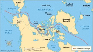
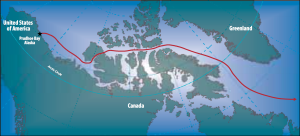
The Northwest Passage connects the Pacific and Atlantic Oceans via an Arctic sea route along the north coasts of Alaska and Canada. The basic routes are shown in the following map.

The Northwest Passage connects the Pacific and Atlantic Oceans via an Arctic sea route along the north coasts of Alaska and Canada. The basic routes are shown in the following map.

Northwest PassageSource: Encyclopedia Britannica

While it has been common for icebreakers, research vessels and nuclear submarines to operate in these waters, it is quite uncommon for commercial or private vessels to attempt to navigate the Northwest Passage.

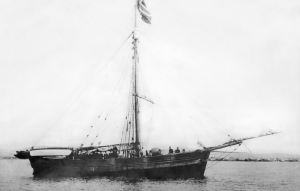
The first recorded transit of the Northwest Passage was made in 1903 – 06 by the famous Norwegian polar explorer Roland Amundsen in the ship Gjoa.

Amundsens ship GjoaAmundsen’s ship Gjoa. Source: Underwood Archives/UIG/Everett Collection

Since then, there have been many full transits of the Northwest Passage. You’ll find John MacFarlane’s list of 126 transits for the period from 1903 – 2006 on the Nauticapedia website at the following link:

http://www.nauticapedia.ca/Articles/NWP_Fulltransits.php

Notable Northwest Passage transits by commercial and private vessels

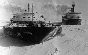
In August 1969, the heavily modified oil tanker SS Manhattan, chartered by Humble Oil & Refining Company, became the first commercial vessel to navigate the Northwest Passage. At the time, the SS Manhattan was the largest U.S. merchant vessel, with a length of 1,005 feet (306 meters), beam of 148 feet (45 meters), draft of 52 feet (16 meters), and a displacement of 115,000 tons. Total installed power was 43,000 shaft horsepower (32,000 kW).

THE MANHATTAN SS Manhattan and CCGS Louis S. St-Laurent. Source: Associated Press

Prior to the Arctic voyage, the SS Manhattan was fitted with an icebreaking bow and heavy steel sheathing along both sides of the hull and in other vulnerable locations to protect against ice. The specific route of the SS Manhattan, from the Atlantic to Prudhoe Bay and then back to the Atlantic, is shown below. Several U.S. and Canadian icebreakers supported the SS Manhattan during its voyage.

Manhattan route 1969Source: NOAA, Susie Harder – Arctic Council – Arctic marine shipping assessment (AMSA)

Oil was discovered at Prudhoe Bay in 1968. A barrel of crude oil was loaded on SS Manhattan in Prudhoe Bay to symbolize that supertankers operating in the Arctic could serve the newly discovered oil field. Further testing that winter off Baffin Island showed that year-round oil tanker operations in the Arctic were not feasible. Instead, the Trans-Alaska Pipeline from Prudhoe Bay to Valdez, Alaska was built.

In 2007, the Northwest Passage became ice-free and navigable along its entire length without the need for an icebreaker for 36 days during August and September. During that period, the sailing vessel Cloud Nine passed through the Northwest Passage during its 6,640 mile, 73 day transit from the Atlantic to the Pacific. You can read David Thoreson’s blog about this Arctic voyage, Sailing the Northwest Passage, at the following link:

http://davidthoreson.blogspot.com/2007/09/completing-northwest-passage-2007.html

This voyage was a remarkable achievement for a small vessel. In his blog, David Thoreson commented:

“I feel strongly that we have witnessed the end of an era and the beginning of a new one. The golden age of exploration, Amundsen’s era, has come to a close, and a new era of exploration involving study and change in the earth’s climate is just beginning. We on Cloud Nine have experienced both eras. Frozen in and stuck in the ice twice over 13 years, and now sailing through unscathed and witnessing an ice-free Northwest Passage. We have bridged the two eras.”

Are we seeing the start of tourism in the Northwest Passage?

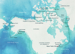
On 10 August 2016, Crystal Serenity departed Vancouver for Seward Alaska and the start of what is scheduled to be a 32-day voyage to New York City via the Northwest Passage. The ship is scheduled to arrive in NYC on 16 September 2016. The planned route for this cruise is shown below.

nwp-map-300-dpiSource: Crystal Cruises

The Crystal Serenity is smaller than SS Manhattan, but still is a fairly big ship, with a length of 820 feet (250 meters), beam of 106 feet (32.3 meters), draft of 25 feet (7.6 meters), and a displacement of 68,870 tons. On this voyage, Capt. Birger Vorland and two Canadian pilots will navigate the Northwest Passage with more than 1,600 passengers and crew.

Crystal Serenity will be accompanied by the icebreaking escort vessel RRS (Royal Research Ship) Ernest Shackleton, which was chartered by Crystal Cruises for this support cruise. Along the planned route, there are few ports that can accommodate a vessel the size of Crystal Serenity. Along most of the route emergency response capabilities are quite limited. Therefore, RRS Shackleton is equipped to serve as a first response vessel in the event of an emergency aboard Crystal Serenity. RRS Shackleton also carries two helicopters and additional crew to support special adventures during the cruise.

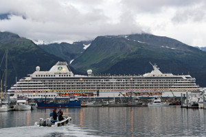
Crystal Serenity at Seward AlaskaCrystal Serenity in Seward, Alaska. Source: NPR.com, Rachel Waldholz/Alaska Public Radio

You can find a current report on the sea ice extent along the Northwest Passage at the National Snow and Ice Data Center’s website at the following link:

http://nsidc.org/arcticseaicenews/

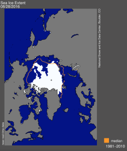
The ice extent report today is shown in the following chart, which shows that the current ice extent is well below the 1981 – 2010 median. However, there appear to be sections of the Northwest Passage around Banks and Victoria Islands that are still covered by the Arctic ice pack. Crystal Serenity is scheduled to be in these waters soon.

Ice extent 28Aug2016Source: National Snow and Ice Data Center

You can track the current position of the Crystal Serenity as it makes its historic voyage at the following link:

http://www.cruisemapper.com/Crystal-Serenity-location?imo=9243667

As of 5:50 PM PDT, 29 August 2016, the ship is approaching Barrow, Alaska, as shown on the following map.

Location of Crystal Serenity 29Aug16Source: cruisemapper.com

A second cruise already is planned for 2017. You can book your Northwest Passage cruise on the Crystal Cruises website at the following link:

http://www.crystalcruises.com/northwest-passage-cruise

Update 24 September 2016: Mission accomplished!

On 16 September, the Crystal Serenity became the first cruise liner ever to transit the Northwest Passage. The west – east passage from Seward, Alaska to New York City took 32 days and covered 7,297 nautical miles (13,514 km).

Crystal Serenity Arrives in New York after Historic Northwest Passage VoyageCrystal Serenity arrives in NYC. Source: Crystal Cruises